Jens Jensen, James Allison, and the History of the EcoLab at Marian University
- Apr 30
- 12 min read
When I think of Indianapolis and landscape architects, my mind naturally goes towards George Kessler, whose guiding hand directed the development of the Indianapolis park and boulevard system just over 100 years ago. But in the early 1900s, at the same time that Kessler was doing his work, another landscape architect was busy at work in the Circle City: Jens Jensen.
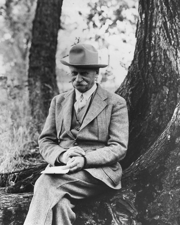
Jensen was born in Denmark and immigrated to the United States in the early 1880s. In 1885 he began working for the West Parks Commission, which maintained parks on the west side of Chicago. During this time he became a proponent of using native plant species for plantings and landscaping in the parks, and, grew fond of the Midwestern terrain, especially the wide open prairies which still existed in places. This led to him becoming the leading proponent of the “Prairie Style” landscape design. “His designs, characterized by recreations of Midwestern prairie and woodland plant communities, were embellished with features of water and stone,” noted a National Park Service bio for Jensen. The water features were often described as “prairie rivers” and designs also promoted “long views” of his landscape, where an observer could have an overall, linear view, of his designs. Jensen designed many parks in Chicago and elsewhere in the Midwest and was an advocate for the creation of a park at the Indiana dunes, which were in danger from the development along the state’s Lake Michigan shoreline.
Jensen was also active with private commissions, and it was in that capacity that he came to Indianapolis. Jensen would only work on a few projects in the Indianapolis area, but one was a sizable endeavor for James Allison, founder of the Allison Experimental Company (now known as the Allison Transmission Company) and one of the founders of the Indianapolis Motor Speedway.

Allison purchased land on what is today known as Cold Spring Road, on the northwest side of Indianapolis, adjacent to Riverside Park. There he constructed a mansion atop a bluff overlooking the shallow valley of Crooked Creek, which cuts through and interrupts the bluff as the creek flows towards the White River. This property is now the site of Marian University. The map below shows this area.

Directly to the north of the mansion is a low, bowl – like area through which Crooked Creek flows known as the Nina Mason Pulliam EcoLab, an outdoor space with a variety of natural habitats including marshland and ponds. Wildlife is also common, with a huge variety of birds, beaver, deer, and enough squirrels to conquer Hamilton County, among others. The lab has a park feel, with a number of trails and interpretive signs throughout the property, and the land is also used for research by Marian University students and faculty. The Google Earth Aerial below shows the southern portion of the Ecolab, and the Marian University campus. Cold Spring Road is at the bottom of the image and the Allison Mansion is on the right, just out of frame.

Allison named his estate Riverdale, and in 1911, hired Jensen to design the landscaping for not only the grounds around the mansion at the top of the bluff, but also for the area which s today known as the EcoLab, the latter of which we’ll explore in more detail.
As noted above, the EcoLab sits in a kind of bowl, created by Crooked Creek and bordered by a low bluff. According to an interpretive panel in the Ecolab, Crooked Creek once ran along the bluff, west of its current course, before it was rerouted to its present position. I was unable to determine when this happened although maps and surveys from the early and mid 1800s seem to support this old route.
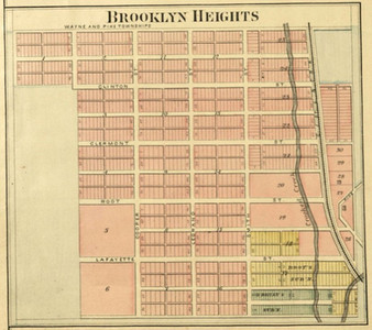
Prior to Allison purchasing the property, the land where the Ecolab now sits had been platted out as a town, called Brooklyn Heights. The town appears in maps in the latter 1800s, although little to no development occurred, aside from a few country homes being built in the area. The map below on the left is from an 1889 atlas of Marion County, showing the plat of Brooklyn Heights. Crooked Creek is in its present position in this map.


Most of the future Ecolab property was later obtained by John J. Cooper, a former Indiana State Treasurer, prior to Allison purchasing the property for his estate. Jensen began his work on the Riverdale estate in 1911. His plan (shown below) was for a series of four ponds which hugged the bluff and followed its line as it curved to the north, creating a “C” shape. A large open area was located to the north of these ponds, while a roadway/path meanders through the area. On the north end of the property a dam on Crooked Creek would create a pond. The full size image of the plan below may be viewed here.

The most recent aerial image available of the EcoLab property and the Allison estate is from 1937, shown below. Note there are five lakes in this image. Lakes 3 and 4 appear separate in the aerial image, while 1 and 2 seem to be connected by a short waterway, versus being separate bodies of water as shown in Jensen's plan. Lake 5 is not shown on Jensen's design. The Crooked Creek pond is also noted.

Jensen planned to use a series of natural springs which flowed out from the bluff to help supply the lakes with the water. These are shown in his plan above. On the western end of the east/west lake, or number two above, were a group of spring houses, constructed of stone, another hallmark of Jensen’s designs. Per interpretive signage, the spring houses had been equipped with machinery to pump spring water up to the Allison Mansion.


The interior of one of these houses contains what appears to be some kind of machinary, or boiler. The other two have water and debris, as shown below.


Near the spring houses is a half-moon shaped raised pool, filled from one of the springs, also constructed in the rock style used by Jensen. However, the signage here indicates that this feature preexisted Riverdale, and had been used to water livestock during the property's agricultural past. It was originally a cement trough (as can be seen on the far side of the pool), but Jensen added the stone layer.

Jensen’s penchant for the “long view” is also on display at the EcoLab. The photo below, from the collections of the Indiana Historical Society, shows the long view looking east from the spring houses discussed above (but out of view in the photo). Cold Spring Road, and the bridge over the Crooked Creek, is visible in the distance. Note the various plaintings in this image. Jensen focused on using native plants in his designs. Note the various plaintings in this image. Jensen focused on using native plants in his designs.

The image above was taken just above a roadway which once connected the Ecolab portion of the Allison estate to the sections on the bluff. That roadway is gone, but the present-day image below roughly shows the long view shown above.

The 'then and now' below shows a view of the Riverdale/Allison Mansion as seen from the shore of the larger lake (#1 on the Google map at the top of the post). The 'then' photo is contained in a photo album of the Riverdale property at the Indiana Historical Society.


Jensen’s design work also extended to Crooked Creek which flows through the east side of the Ecolab. As shown in Jensen's original plan, a dam was planned on the creek to create a small pond, a part of his “prairie river” vision. Two stone bridges with natural surface decks were also constructed on the north and south side of the pond.
This dam was built in the same stone style as the spring houses and bridges. The remains of the dam (shown below) are still visible on Crooked Creek, and near a striking similarity to the old Emrichesville Dam on the White River near 16th Street.


As can be seen in the image below, it appears the creek’s course has cut around the western abutment of the dam, the concrete wall in the foreground, compromising its water retention purpose. The normal course of the creek would have been from left to right, and but on the far side of the abutment.The second image is looking downstream towards the ruins of the dam and the southern bridge.


The pond created by the dam is no longer there. Aerial imagery from 1937 show it still in place, although by 1956, it appears the creek has returned to its normal channel and the pond is drained. The image below shows the pond from its northern end, looking south, or downstream, towards the dam and bridge, shown above. This image appears on an interpretive sign at the EcoLab. I was unable to find the original image in local archives.

A bit upstream from this point is a second dam with a narrow bridge over its top. This was not included in the Jensen plan shown above. When it was constructed is not clear, although its design is similar to the other bridges over Crooked Creek which were part of Jensen's plan.

This area of the EcoLab has a more complicated ownership history. While most of it was owned by Allison, in the 1910s there were a series of property transactions between Allison and his neighbor to the north, Charles B. Summers, with Summers obtaining more land on the north side of Riverdale, along Crooked Creek. Summers was a businessman with interests in automotive companies and a furniture company in downtown Indianapolis. Summers would construct a massive home (shown below) on the bluff on the east side of Crooked Creek in 1923-24.

A short notice in the Indianapolis Star in 1918 indicated that a contract for a dam on Crooked Creek on the Summers property had been let. The dam was intended to provide water to a fish hatchery which was being constructed nearby where the Major Taylor Velodrome is located today. Per the Star article, the bridge was to be constructed of "concrete, limestone, and bowlers." Bowlers appears to be the type of stone used by Jensen in his various structures on the Riverdale property and it seems the dam was constructed to match that style.

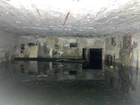
Summers was reputed to have enjoyed entertaining, including celebrities and at times royalty, and his estate had a variety of features for this, including a miniature golf course, now part of the Ecolab, and a Japanese Garden. Another feature of this section of the property are the remains of an elaborate pool house (sometimes referred to as a bathhouse) which was located on the eastern side of Crooked Creek.


At one point, the pool house had a richly appointed interior, although today only the bare stone walls remain, along with the remnants of piping and some tile. The lower levels of the pool house, and its access stairway, are flooded, as shown below.


The pool house's companion swimming pool was located on its west side, along the banks of the Crooked Creek pond discussed above. The bathhouse was also made of stone although it was not part of Allison's estate, since the Allison mansion had an indoor pool, and the Summers home was not built until several years after Jensen completed Riverdale. Instead, the use of similar stone to Jensen's work seems to have been another attempt to blend the pool house into the existing structures on the property, including the nearby bridges.
A schematic of bathhouse and swimming pool area of the Summers estate is available through the Digital Indy archive at the Indianapolis Public Library. North is down on this plan, but the pond, the dam, and both stone bridges are shown, as is the planned "pavilion" and swimming pool.

The plan is titled "Bathing Pavilion & Swimming Pool," and "originated & Planned by Mr. & Mrs. Chas. B. Sommers." The date of the plan is odd, and says "10/1-10/18" and "11/26/29." The date range is confusing, but I think the plan was developed in late 1929. Further, in 1933, an Indianapolis News article exploring private and estate pools around the city, references the pool and bathhouse at the Summers estate, noting it is the best part of the summer at the estate. “In fact, the casual caller would do well to search down at the bathhouse, before ringing the front doorbell, for it is there the family spends the lazy summer days,” reported the News.
The Summers home, also called Stewart Manor, still stands, and is owned by Marian University, and almost seems like a twin to the Allison Mansion, with both mansions being located on high points on either side of the gap in the ridge line created by Crooked Creek. Additionally, the old property lines between the Allison and Summers property are still visible thanks to an old iron fence which can be viewed at different points around the EcoLab property, including along Cold Spring Road.
As for the Summers property, there is no sign of the pool today. In fact, the land behind the bathhouse, where the pool would have been, is heavily grown over with trees and honeysuckle. Despite using my canal hunting skills, I could not discern any indentation or depression left over from the pool. When it was filled is not clear, although based on aerial images, it seems like it was between 1956 and 1962. While the Summers property pool and pool house was constructed in an area which was part of the Jensen design, it does All the construction uses rock, but of a different style than the “bowler” rock favored by Jensen. There are stone walls along the creek's banks which were part of Jensen's design, especially in the area around the "prairie lake." The image of the lake shown earlier in this post shows these walled banks, and they can still be seen today. The present day photo below shows these walls, along with the stone bridge on the northern side of the pond.


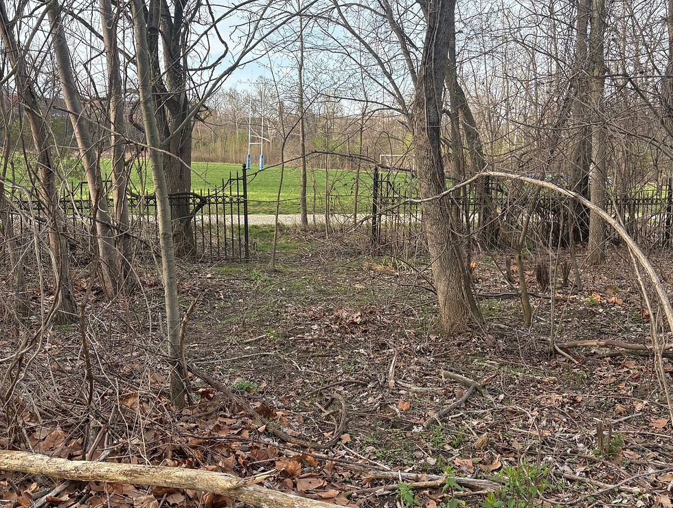
Jen Jensen died in 1951. Allison predated that, passing in The Ecolab was opened in 2002. Invasive species were removed, trails built, or in some cases trails leftover from Jensen's design were uncovered, some with board walks to allow hikers to cross marshy ground. New plantings of native plants were launched. The large field area visible in Jensen’s plans had been used as a baseball field, and continued to be a sports field, usually rugby from the times I have been at the property. A small version of Jensen's larger bridges is located on the northwest side of the property, providing a walkway over a small stream.

Today, the foundation of Jensen’s work on the property can still be seen. The four lakes in Jensen’s original plan are now one large lake, created by the elimination of some of the land bridges in Jensen’s plan. On the north end, the extra lake (#5), not included in Jensen's plan, has been transformed into a marshland, a common feature on the property, with other areas of marshes developing in the years after the Allison family sold the property. An outdoor classroom has been constructed in the middle of the EcoLab, in between two marshlands, one of which is lake 5.

An active beaver colony (complete with a large lodge in one of lakes) live in the Ecolab, and the property is crisscrossed by their canals connecting the marshes together. Despite visiting the Ecolab for the past few years, I have yet to see one of its resident beaver, although I see them regularly along the Central Canal and the White River near my neighborhood. In addition to a wide range of birds, I have also seen coyote, many deer, mink, and in November of 2025, a river otter, although I think the otter was a transient, and just passing through the area.

The image below is panoramic of the EcoLab, as it was in 1915. The Allison Mansion can be seen on the bluff overlooking the ponds. On the far left is the Cold Spring Road bridge over Crooked Creek. The second image below shows the same view today. Note the increase in vegetation between 1915 and the present.


If you look on the right side of the 1915 image (zoom in using the full size image at the Indiana Historical Society) you can just see the spring houses pictured earlier in this post.

The Ecolab is one of my favorite outdoor spaces in the city, and is made more special if you can appreciate the vision and work of Jens Jensen. Marian University and its staff should be commended for the work they have done to preserve this space as a natural refuge, and as an example of Jensen’s historic landscaping design.
Sources
Jens Jensen,"Apostle of the Dunes," National Park Service, https://www.nps.gov/people/jens-jensen.htm
Nina Mason Pulliam EcoLab, https://www.marian.edu/nina-mason-pulliam-ecolab/
Indianapolis Star: March 29, 1911, April 30, 1912, September 13, 1912, February 15, 1914, October 21, 1918, August 28, 1919, November 7, 1916, December 13, 2002
Indianapolis News: September 12, 1912
Bathing Pavilion & Swimming Pool Originated and Planned by Mr. and Mrs. Chas B. Sommers, https://www.digitalindy.org/digital/collection/ipsad/id/2244
Jens Jensen Drawings and Papers, Bentley Historical Library, University of Michigan, https://findingaids.lib.umich.edu/catalog/umich-bhl-97105
View of Road and Bridge at Allison Estate, Indiana Historical Society, https://images.indianahistory.org/digital/collection/dc013/id/618/rec/22
Photo Album of Riverdale, James A. Allison's Home, Indiana Historical Society,
Robert E. Grese, "Jens Jensen : Maker of Natural Parks and Gardens," 1992, Internent Archive, https://archive.org/details/jensjensenmakero0000gres/mode/1up
Leonard K. Eaton, "Landscape Artist in America; The Life and Work of Jens Jensen, 1964, Internet Archive, https://archive.org/details/landscapeartisti0000unse


Comments