Panorama of White River State Park: A Closer Look
- Oct 29, 2021
- 10 min read
Updated: Sep 1, 2022

A while back I ran across a pair of panoramic photos in the Indiana Historical Society Digital Collections which were taken in 1981 from a vantage point in the present day White River State Park, although at the time, the park was still a work in progress. One of those images, with a view east and south of the proposed park, can be seen above. Some readers may recall I took a detailed look at a panoramic photo from 1910 in a post from few years ago. That post can be accessed here. Considering these White River State Park photos were taken 40 years ago this year, it seemed appropriate to take a look back at the city as it appeared at that time, and I chose the above image to investigate. The sections of the photo which will be highlighted in this post are marked below by the number that each section will be discussed. The full image from the Historical Society's page can be accessed here, and I encourage readers to review this link in conjunction with this post. The image quality is far better than what I can post to the blog.

Photo #1: AUL Tower Topping Out

Designed by Skidmore, Owings & Merrill and completed in 1982, the then named AUL Tower was the tallest building in Indiana for several years, topping out at 38 stories and 533 feet. The building currently known as the Salesforce Tower became the tallest upon its completion in 1990. AUL had for many years been based at its headquarters at Illinois and Fall Creek Parkway, on the north bank of the creek. That building was just to the east of the old St. Vincent Hospital, and is now used by Ivy Tech.
The sale of the building to Ivy Tech was a hot topic in the late 1970’s, and in June of 1978, the trustees for Ivy Tech affirmed their intent to purchase the AUL building for a new Indianapolis campus, although state approval was needed. The American United Life Insurance Company indicated to the Indianapolis Star that should the State Budget Committee approve the purchase of their building by Ivy Tech, they would proceed with the construction of a high rise headquarters downtown. If Ivy Tech was not to be the purchaser, AUL intended to remain in its Fall Creek building, and expand its operations on that property. In the panoramic, taken in what appears to be the middle of 1981, the AUL Tower is nearing its topping out, although interior work would still need to be done.

The Indianapolis Digital Mayoral Archives contain photos of Mayor William Hudnut touring the unfished AUL Tower, likely in December of 1981. The image above shows the mayor on what appears to be the top of the tower, where the present day Skyline Club is located. Note the snow on the ground and in the background. Other images in the archive show the mayor touring other, more complete, floors lower in the tower.
Photo #2: The Last Days of Oscar McCulloch School Number 5

IPS School 5 once stood where the front lawn of the Indiana State Museum is today. The school was named for Oscar McCulloch, a minister and president of the Indianapolis Benevolent Society in the late 1800’s, who oversaw an expansion of that organization’s work. Constructed in the early 1920’s to serve the working-class neighborhoods around the school, and along the White River, the school had a diverse student body, with many children from immigrant families, along with various racial groups, including African- and Chinese-Americans. The school was converted to serving students with special needs in 1968, before closing in 1980. Note the number "5" written on the roof of the building, and the detailed brick and tile work on the building's exterior.

With the advent of White River State Park, the now unused and increasingly dilapidated school building was slated for demolition, although a community outcry prevented a total demolition. The image above shows the mostly demolished School No. 5 in 1986. Note to the left of the structure is the Acme Evans Mill facility, and the likely vantage point of the panoramic image at the top of this post. As for School No. 5, the intricate façade of the building which had faced Washington Street was saved, and was later reconstructed in the lobby of the new Indiana State Museum, as pictured below.

Photo #3: The American Fletcher National Bank Building,

The American Fletcher National Bank was one of the largest banking institutions in Indiana for over a century. As described in the Encyclopedia of Indianapolis, the history of American Fletcher National Bank, and its successor, Bank One, is "long and complex," and is better suited for a standalone blog posting, or even better, a article or book.
For the purposes of this posting, a short summary of the bank's history will have to suffice. Tracing its roots back to the bank started by Stoughton A. Fletcher, the youngest brother of Calvin Fletcher, in 1839, the bank continued to grow under the control of the Fletcher family in the second half of the 19th century. In 1901, the American National Bank was founded in Indianapolis, and in 1910 it merged with the Fletcher National Bank under the leadership of Stoughton Fletcher's grandson, Stoughton Fletcher II. Fletcher was forced to step away from the company in the 1920's due to personal financial losses which saw his fortune virtually depleted, and in 1933, the bank did not reopen following the March 1933 banking holiday. The institution would eventually reopen under a federal trustee, but without the "Fletcher" name, the bank now being called American National Bank.
Another institution, the Fletcher Savings and Trust Company, was created in 1912 through the merger of two local institutions, and continued to operate. Its name was changed to the Fletcher Trust Company in the 1930's, and in 1954 it merged with the American National Bank, making the new entity, AMerican Fletcher National Bank ("AFNB") the second largest bank in the state. Additional acquisitions over the next few years resulted in AFNB becoming the largest by the end of that decade.

In 1987, AFNB merged with the Banc One corporation in Columbus, Ohio, and after additional consolidations of local banks, the Bank One Indiana corporation was created. The "AFNB" sign in the photo was on top of the present day Hilton Garden Inn, originally known as the Fletcher Trust Company Building, at Market and Pennsylvania Streets. The sign was later changed to “Bank One” and the remains of "Bank One" are still visible today, although the bank's name was later changed, and operations were relocated following the completion of the nearby Bank One Tower, now known as Salesforce Tower.
Photo(s) #4: Fast Food on Washington Street


West Washington Street in 1981 included two locations for major fast food chains: Burger Chef and White Castle. White Castle began in September of 1921 in Wichita, Kansas, and has always had a strong presence in the Indianapolis area. The ad from the Indianapolis News, shown below, includes one of their regular coupons which were included in newspapers in 1930’s and 40’s.

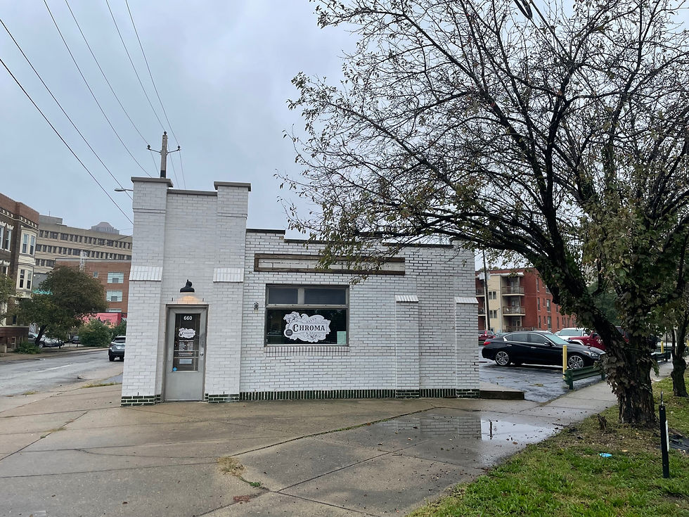
The location in the panoramic photo is the 601 Washington Street (at California) location included on the above advertisement, roughly located at the bend in Washington Street where the Courtyard by Marriott now stands. Of all the locations listed in the ad, the only surviving site is at 650 Ft. Wayne. The building is currently occupied by Chroma Salon and Studio. The building, pictured below, is very similar to the White Castle in the panoramic photo, and the illustration in the advertisement.
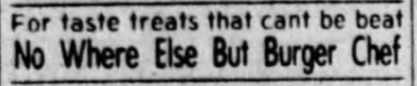
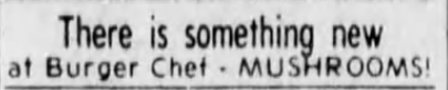
The second fast food location is a Burger Chef, an Indianapolis original founded here in 1954 before expanding across the country, and into Canada. Unfortunately, Burger Chef today is most often associated with the kidnapping and murder of four employees from the Speedway restaurant in 1978. Following a decade where the chain struggled with consistent branding and encroachment by competitors, the chain was sold in 1982 to a company which also owned Hardees, and many locations were converted to Hardees, with others being closed. The downtown location pictured here was located in the block of Washington Street between Missouri and West Streets, where the state parking garage is now. The ads below came from the Indianapolis Star during the summer of 1981. Strangely, these ads were found in the traditional classifieds section.
The last Burger Chef in the United States was operated in Cookville, Tennessee, and closed in 1996. While the downtown location pictured above no longer exists, other former Burger Chef buildings exist in the Indianapolis metropolitan area, including the Speedway location at 5725 Crawfordsville Road and various Hardees locations, although some sites have had the original Burger Chef building demolished and replaced with new structures. It appears that the building for the location at 6160 Allisonville Road is still standing, although the exterior has been modified. Another location is 6513 N College Avenue, which is currently a Forum Credit Union.
Photo #5: The Fair Building
This building was the subject of an earlier post, which can be found here. The panoramic image predates the construction of the Westin and Marriott Hotels which surround the building today. Also visible behind the building is Pearl Street, today nothing more than an alley at several points in downtown, but then more of a full roadway.

Photo #6: From Industry to Baseball

Previously occupied by a variety of industrial operations, most notably the Kingan & Company slaughterhouses, and some residential properties, by 1981 the land south of Maryland Street and north of the Diamond Chain factory had been cleared for redevelopment. Kingan was one of the city’s oldest business operations, having been started by the Kingan family in Ireland in 1845, before expanding to the United States in 1851 with the company based in New York and Cincinnati. Kingan moved their business to Indianapolis in 1862, gaining a foothold by purchasing an existing packing facility, and then expanding operations just west of downtown, eventually owning land on both sides of the river. A major employer in the city, the Kingan operations were also recognized as source of significant pollution from the various production facilities early in the 20th century. The firm was closed in 1966, and the vacant property suffered several fires before the remains of the buildings were razed around 1970.
Parking lots and empty space, and the rerouted Maryland and Washington Streets, occupied the land during the 1980's. The early 1990’s brought discussions about the Indianapolis Indians baseball team's need for a new stadium, and a move from their long-time home at Bush Stadium (formerly known as Victory Field and even more formerly known as Perry Stadium). After some speculation as to the location of a new stadium, in 1994 a downtown location in White River State Park, south of Maryland Street, was finalized.

Photo #7: General Motors Stamping Plant

The GM Stamping plant was one of the cornerstones of manufacturing in West Indianapolis for almost 80 years. First opened in 1930 after General Motors obtained the site of the former Marten Parry Co. (previously known as Parry Manufacturing Company), also an automobile manufacturer, the facility was expanded over the years to over 100 acres. The facility closed in 2011, and most of the structures on the sight were demolished, save the framing for one of the production bays for the factory.

The limestone administrative building pictured in the center of the panoramic image was also demolished, although the circular foundation of the central tower is still visible. Various redevelopment proposals were considered for the site, and after one developer backed away from the project, it was announced in December of 2020 that Elanco Animal Health, a former subsidiary of Eli Lily Co., would construct its new headquarters on the site. An Indianapolis Star report on December 5, 2020 noted that Elanco intended to break ground during the first half of 2021. However, as of the date of this post, no work has begun at the site. The image slider below shows the site from 1941, 1986, and 2021.


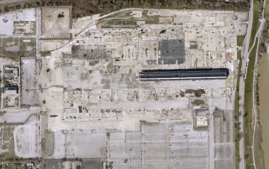
Photo #8: Washington Street Pumping Station

Chicago has its Water Tower, and Indianapolis has the Washington Street Pumping Station. The former may be more well known thanks to its fire related history, but the Washington Street Pumping Station has its own nearly century long history of service to the city. Constructed in 1870 as part of the newly founded Water Works Company of Indianapolis, the station came online in 1871 and housed a steam powered Holly pump to draw water from a large well, in addition to three pumps, driven by water flowing in from the Central Canal, to push the well water through the mains for commercial and residential use, and for fire protection. However, early on, there were only 5 miles of mains and 200 fire hydrants to feed.

The Water Works Company failed in The pumping station continued to utilize canal waters to drive the turbines within the station which in turn pumped water (from wells, not the canal) through the company’s system. In the 1889 the system was supplemented by the construction of the Riverside station and the installation of pumping systems at that facility. In 1904-05, the water company’s new filtration plant east of Fall Creek and north of 16th Street came online (now known as the White River Filtration Plant). For the first time water from the canal was treated, and then routed to the Washington Street station via gravity for distribution into the water system. The Washington Street station was inundated by the flood of 1913 and failed, along with the Riverside station, and the rest of the water company's infrastructure. Originally shaped like a "T", the bottom of the T faced north and was destroyed in a 1927 tornado which raged through the city, with a particular impact on the eastside of downtown.

The Washington Street station continued to be used for pumping purposes for the next 50 years, although with the growth of Indianapolis, its efforts were supplemented by pumps in other locations, along with the use of water towers to assist with water pressure issues, and new reservoirs. In 1969 the Washington Street station was taken offline, as the canal was being phased out below 16th Street, and the station’s pumps were no longer needed due to enhancements elsewhere.

Since that time, the station has been used for a variety of purposes, including as a visitor center for White River State Park. The station was added to the National Registrar of Historic Places in 1980, and was named an American Water Landmark. A link to the application for the national register designation can be found in the sources below. At present, I'm not sure for what purpose the station is being used. There are various trailers, cooling units, and soda machines sitting around outside of the station, and the inside has a variety of...stuff strewn about. It does not appear to be open to the public at this time.
Sources
Indianapolis Star: August 14, 1941 June 8, 1978, December 5, 2020
Indianapolis News: November 13, 1922, June 21, 1933
Kingan and Co., Collection Guide, Indiana Historical Society, https://indianahistory.org/wp-content/uploads/kingan-and-company-collection.pdf
Bawel, Kelsey, “A Building in a Building: Oscar C McCulloch School No. 5,” Discover Indiana, accessed October 23, 2021, https://publichistory.iupui.edu/items/show/11.
American Fletcher National Bank Collection Guide, Indiana Historical Society, https://indianahistory.org/wp-content/uploads/american-fletcher-national-bank-of-indianapolis-addition-1953-1998.pdf
Gale, Fredrick, Digital Indy, Indianapolis Public Library, A Biographical Study of Persons for Whom Indianapolis Schools Are Named, https://www.digitalindy.org/digital/collection/ips/id/344464/rec/22
Washington Street Pumping Station, National Register of Historic Places Nomination Form
https://secure.in.gov/apps/dnr/shaard/r/21630/N/West_Washington_St_Pumping_Station_Marion_CO_Nom.pdf
Bodenhamer, D. J, Barrows, R. G, & Vanderstel, D. Gordon. (1994). The Encyclopedia of Indianapolis. Bloomington: Indiana University Press. (American Fletcher National Bank, Burger Chef)
Overhead View of the Original Purchase of General Motors Plant, Indiana Historical Society (1930), https://images.indianahistory.org/digital/collection/p16797coll53/id/1353/rec/180
Indianapolis Digital Mayoral Archives, University of Indianapolis Institute for Civic Leadership, The William H. Hudnut, III Collection, Mayor Hudnut Tours AUL Tower Construction, December 28, 1981, Img. 38
Indianapolis : from wells to reservoirs, Indianapolis Digital Collections, https://www.digitalindy.org/digital/collection/iwc/id/144/rec/62

Comments